
Johnson County ZIP Code Coverage
Sixteen delivery ZIP codes serve or intersect Johnson County. They are a practical way to organize an address search, but each is a USPS delivery construct rather than a county boundary. Alvarado, Godley, Grandview, Joshua, Keene, Rio Vista, and Nemo each have familiar local service areas. Cleburne uses both 76031 and 76033. Several other labels extend across jurisdiction lines, so a postal city cannot settle a county or municipal question.
| ZIP | Area served in or near Johnson County | Service note | Record-search caution |
|---|---|---|---|
| 76009 | Alvarado | Alvarado service area | Verify the street-level result. |
| 76031, 76033 | Cleburne | Two Cleburne delivery areas | Neither is a city-limit test. |
| 76044, 76050, 76058, 76059 | Godley, Grandview, Joshua, Keene | Local service areas | Rural routes can differ by address. |
| 76070, 76084, 76093 | Nemo, Venus, Rio Vista | Rural or small-community service | Check USPS before relying on the label. |
| 76028, 76035, 76036, 76063 | Burleson, Cresson, Crowley, Mansfield areas | Cross-county delivery geography | Do not assume a Johnson-only result. |
| 76061, 76097 | Lillian and Burleson routes | PO Box-oriented routes | A box ZIP is not a parcel location. |
The county-wide set is a research aid, not a static USPS station list. The research did not verify every rural carrier boundary or station name. Use the address tool for the final delivery answer.
Johnson County ZIP Directory Routes
Use the USPS ZIP Code Lookup with a complete street address to confirm the delivery ZIP before opening a county portal. USPS knows the delivery assignment. The Central Appraisal District knows the parcel and owner record. County GIS knows mapped geography, and the 911 address process assigns emergency addresses in unincorporated areas. Those systems can all return useful, different labels for the same place.
The distinction is important in Johnson County. Burleson, Mansfield, Crowley, and Cresson delivery geography crosses county lines. A Cleburne label may describe a route rather than a municipal boundary. Rural addresses may use a community name while the parcel lies beyond a city limit. Treat the postal answer as a key for mail and address confirmation, then choose the custodian that matches the next question.
Finding Johnson County Residents by ZIP
A Johnson County ZIP code directory can narrow an address task, but county portals are not all ZIP-search tools. JCAD exposes street number, street name, subdivision, neighborhood, property ID, owner, and tax-year fields. The Tax Office search uses account, owner, and property-location terms. The individual voter tool uses a name plus county and date of birth or an identity route. It does not offer a public browseable ZIP roster.
- Confirm the delivery ZIP with USPS using the full address.
- Open JCAD eSearch and search the street name, number, subdivision, or neighborhood to locate the parcel.
- Compare the JCAD situs address with the owner mailing address and property or geographic ID. They can differ.
- Use the County Tax Office search as a second address and account check.
- When a ZIP leaves several streets, use the detailed Johnson County street-address directory process rather than assuming the ZIP identifies a household.
The Secretary of State voter-status route is for an individual lookup. A statewide voter-list request has county and other statutory filters, but the research does not document a ZIP filter and protected addresses stay excluded.
Johnson County Portal Search Fields
JCAD is the strongest Johnson County property route after a ZIP has been converted into a street address. Its published form is not ZIP-capable, which is itself useful search guidance. Start broad with the street name if the full address does not match, then use Advanced Search to reduce a large result set.
The JCAD eSearch page provides the Johnson County property fields used after USPS has confirmed a delivery address.
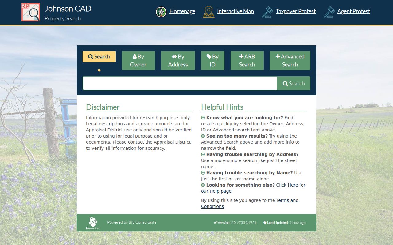
Its street, subdivision, neighborhood, parcel, and owner paths connect a delivery ZIP to an assessed parcel without claiming that JCAD has a ZIP search field.
| JCAD field | How it helps after ZIP verification |
|---|---|
| Street Number and Street Name | Locates the assessed situs when a full delivery address is known. |
| Subdivision and Neighborhood | Narrows a group of parcels inside a local area. |
| Owner Name or Owner ID | Checks a taxable owner, not every resident. |
| Property ID or Geographic ID | Connects a parcel result to GIS and property records. |
| Tax Year and Property Type | Refines the current appraisal search. |
The JCAD GIS viewer adds a map route with Search for Parcel, Map Layers, and Legend. Its dynamic screen did not expose a confirmed ZIP layer or searchable ZIP field in the research.
USPS Checks for Johnson County ZIP Codes
The USPS address lookup is the official source linked with this ZIP code directory for a live address result. The available capture shows the address-based lookup surface rather than a Johnson County result, so enter the complete local address before recording a ZIP. It is especially helpful for rural routes, PO Box use, and communities whose delivery areas meet other counties.
USPS provides the address-to-ZIP lookup used for this Johnson County ZIP code directory.
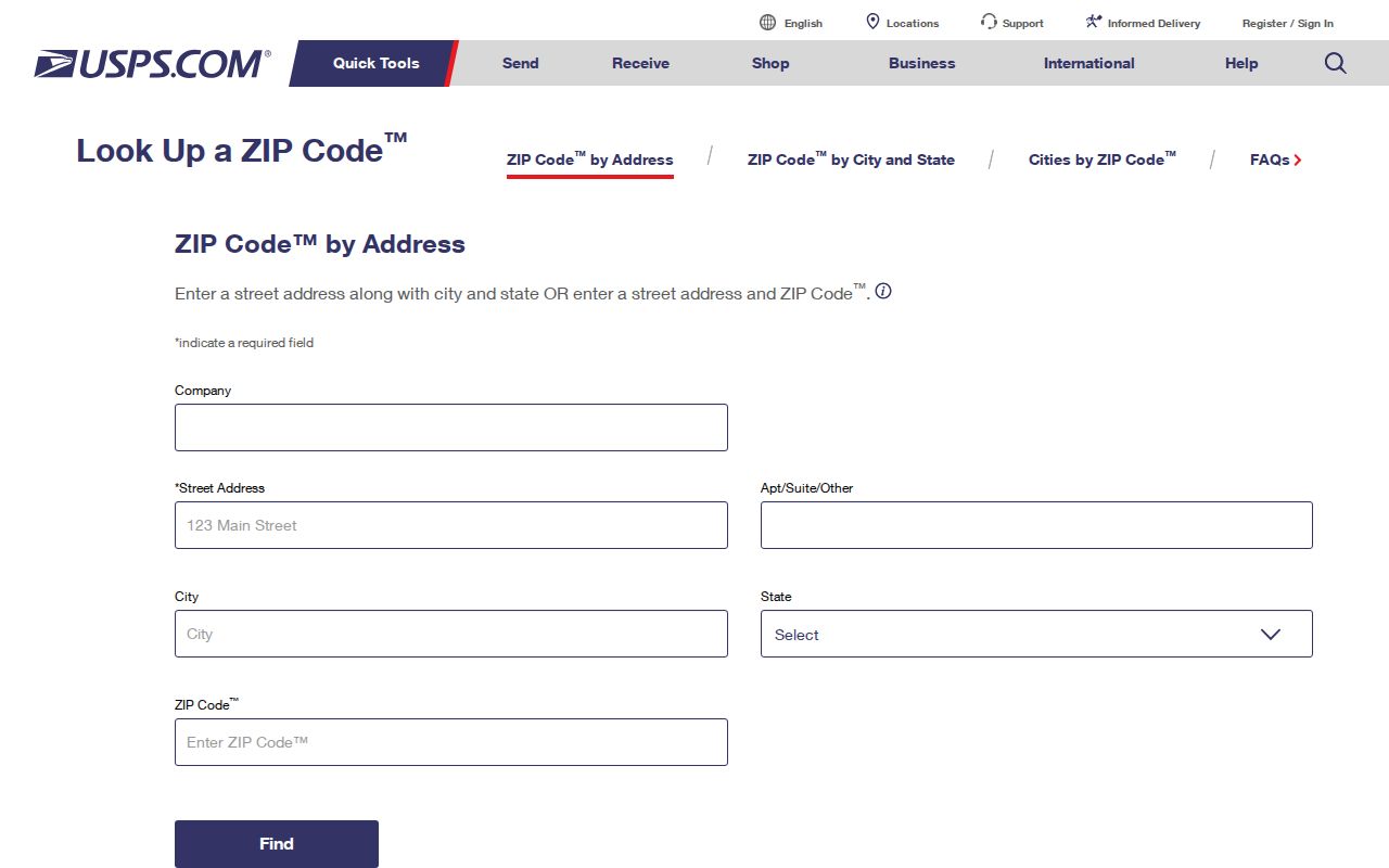
Use its returned delivery label as a starting point, then compare it with JCAD parcel data or county GIS when the question concerns a mapped address rather than mail delivery.
Johnson County ZIP Codes and City Lines
ZIP boundaries and Johnson County city limits answer different questions. USPS assigns a ZIP from delivery routes and addresses. The Census creates ZCTAs as generalized map polygons. County GIS maps precincts, city limits, and roads. JCAD maps appraisal parcels. A valid ZIP may have no ZCTA, and a PO Box or unique ZIP may have no useful geographic polygon.
That mismatch appears at the county edge. A Burleson, Mansfield, Crowley, or Cresson mailing label can overlap more than one county. A county tax account can carry a mailing address that is elsewhere, while its situs address identifies the assessed parcel. Check each source for its own purpose rather than treating any one label as a universal location.
- ZIP and ZIP+4
- A ZIP identifies a delivery area; ZIP+4 adds a smaller delivery segment.
- PO Box ZIP
- A route used mainly for post-office boxes, not a continuous neighborhood.
- Unique ZIP
- A delivery code assigned to a single organization or large recipient, when USPS uses one.
- Carrier route
- A mail-delivery sequence within a ZIP, not a legal parcel boundary.
Johnson County 911 Addressing
Johnson County GIS maintains the 911 address database and street-centerline ranges. For an unincorporated structure, placement follows the driveway along the right-of-way; city-limit structures follow road and city rules. The county accepts a 911 address request online or in person through Public Works at 2 N Mill St, Suite 305, Cleburne. Research notes an expected contact time of one to two business days and a typical one-to-five-business-day plat-addressing window.
That process explains why an emergency address, a postal city, and a deed description can each use different words. A corner lot may have two possible addresses until its orientation is known. Developers submit street names before platting. For a historic or hard-to-match address, compare a plat, a Sanborn map, a printed directory, and the 911 centerline rather than relying on exact text alone.
Johnson County Mailing and Situs Records
A common search mistake is to treat the JCAD owner mailing address as a residence. JCAD separates the mailing address from the situs, or property, address. A trust, estate, business, tax agent, or nonresident owner can receive mail away from the parcel. An exemption can be a useful occupancy clue, but it is not a public list of everyone at an address.
Keep a small record log: the address entered, the USPS answer, JCAD property or geographic ID, the tax-account result, the date checked, and the claim each record can support. This comparison is the Johnson County ZIP code directory's most important limit. It prevents a route label or mailing address from being mistaken for proof of a current household.
Johnson County ZIP Research Fallbacks
When an online result is incomplete, use the documented fallback chain. Ask JCAD to explain parcel or legal-description questions. Use County GIS or the 911 coordinator for an assigned-address issue. Ask the County Clerk for plats and recorded instruments that link a lot or abstract to a street. For older household research, the Cleburne Public Library local-history archive, UNT newspapers, the State Library finding aid, and clerk public terminals may answer what a postal tool cannot.
The Texas Public Information Act, Texas Government Code Chapter 552, permits a reasonably described request to the governmental body that holds public information, subject to statutory confidentiality. It does not open protected voter addresses, motor-vehicle information, adoption records, sealed court material, or Address Confidentiality Program information. Those limits remain in place even when a person has a Johnson County ZIP code.
Note: The useful next source depends on whether the question concerns delivery, a parcel, an owner, a map boundary, or historical occupancy.