
Walk a Johnson County Street by Address
A Johnson County search works best as a short chain, not as a list of names. Begin with the property itself, because the appraisal record supplies the parcel identifiers that survive when a street number is missing from an older deed. Then separate an assessed owner from a current occupant. The JCAD eSearch record can show the parcel's situs, or physical property address, and an owner mailing address. Those fields can match, yet they do not always do so. A tax account, deed, voter status record, or historical directory serves a different purpose and should be read on its own terms.
- Enter the street number and street name in JCAD. If the match fails, try the street name alone and narrow the result with the subdivision, neighborhood, or property identifiers.
- Write down the property ID, geographic ID, legal description, assessed owner, situs, and mailing address. These details make the next searches more precise.
- Open the JCAD GIS parcel viewer to place the parcel along the road and compare the surrounding lot shapes.
- Search the owner and legal description in the Johnson County Official Records index. A purchase instrument can lead to the seller and an earlier transfer.
- For an older household, search the street, nearby intersection, and surname in local directories and newspapers. A historic entry may describe a renter or boarder rather than the owner.
Use the state voter tool only to confirm an individual when the required identifying information is already available. It is not a street-browsing roster, and protected addresses may be withheld. The point of the Johnson County street directory method is to keep ownership, registration, and historical occupancy from being merged into one unsupported claim.
Search Johnson County Streets in JCAD
JCAD is the main current parcel entry point for a Johnson County street search. Its search screen offers owner, address, ID, and advanced routes. Street Name is useful for a broad road search, while Street Number can reduce a result set. Subdivision, Neighborhood, Property Type, and Tax Year provide further ways to distinguish similar addresses. The live public capture did not establish whether a whole-street result can be exported or paginated beyond the visible display, so preserve the search terms and work through the results rather than assuming a complete download is available.
Search the parcel first, then inspect the record rather than relying on a search suggestion. JCAD describes the service as a research tool and advises independent verification of legal descriptions and acreage. A result can give a strong address and ownership lead, but a deed or clerk record is the right next channel when the issue is a recorded transfer.
| JCAD field | Field type | How it helps a street search |
|---|---|---|
| Street Number | Text | Targets a particular numbered parcel. |
| Street Name | Text | Browses a road when the number is unknown or needs checking. |
| Property ID / Geographic ID | Text | Connects the appraisal record to mapped parcel geometry. |
| Subdivision / Neighborhood | Autocomplete | Helps distinguish repeated road names and planned areas. |
| Tax Year / Property Type | Dropdown | Narrows the current appraisal search. |
The JCAD eSearch screen shows the owner, street, property-ID, subdivision, neighborhood, and advanced controls used for a Johnson County street directory search.
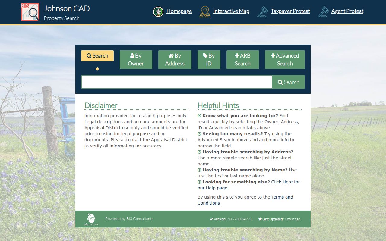
Use those fields to locate an assessed parcel, then compare its situs and mailing details before treating a name as an address connection.
Note: JCAD exposes address and parcel fields, but the research did not verify a street-wide export or published historical-depth statement.
Johnson County Street Mailing and Situs
One Johnson County parcel commonly has more than one address label. The situs address is where the parcel sits. The owner mailing address is where tax correspondence goes. A legal description identifies land through a subdivision lot and block or through survey, abstract, and metes-and-bounds language. The Johnson County Tax Office search makes this distinction explicit: “Property Location” means the actual situs, while “Owner Address” means the mailing address. Its location hint asks users to omit the street type and direction.
That difference matters for a street directory. An owner may receive mail away from the parcel, and an exemption is only a clue about occupancy. It does not identify every person at an address. Match the address type to the question before recording a conclusion. When a historic deed does not use a modern street number, the legal description and parcel identifiers are better bridge terms than an exact address string.
- Parcel
- A defined piece of real property recorded and assessed as a unit.
- Situs address
- The physical location used for the assessed parcel, not necessarily the owner's mailing location.
- Legal description
- The lot, block, subdivision, survey, or metes-and-bounds wording that identifies land in an instrument.
- Plat
- A recorded map that can connect lots, blocks, streets, and easements within a subdivision.
Map a Johnson County Street Parcel
The JCAD GIS viewer visibly provides Search for Parcel, Map Layers, and Legend. Search the address or geographic ID, select the parcel, and zoom along the road. The outline can help distinguish an adjoining lot, a right-of-way, or a different subdivision before you open another appraisal record. The county's interactive maps add county, precinct, major-thoroughfare, and city-limit context.
A map is a geography tool, not proof that someone owns or occupies a property. The text-only research capture did not verify the viewer's buffer, measuring, export, or selected-parcel controls, so those features should not be assumed. For a Johnson County street directory search, use the map to locate the parcel, then return to JCAD and the County Clerk index for the record evidence.
Address flow: street number and name → JCAD parcel and legal description → GIS location check → County Clerk deed index → historical directory or newspaper context.
Johnson County Street Records by Address
Address-keyed sources overlap, but they are not interchangeable. JCAD is strongest for the present appraisal parcel. The Tax Office offers account and payment-status clues. The County Clerk preserves recorded transfers and plats. The county 911 function explains how unincorporated addresses are assigned, while municipal permit systems can date work at an address. Historical directories add occupancy language that current parcel records do not supply. Combining them carefully produces a more useful Johnson County street directory result than any one source alone.
| Address record | Custodian | What it can establish | Access route |
|---|---|---|---|
| Appraisal parcel | JCAD | Owner, situs, mailing address, legal description, value, and parcel identifiers. | Free eSearch. |
| Tax account | Johnson County Tax Office | Owner or mailing address, property location, account and paid or unpaid status. | Free online search. |
| Recorded instrument | Johnson County Clerk | Grantor, grantee, document type, date, legal description, lien, release, or transfer history. | Online index, clerk terminal, or written copy request. |
| Plat and 911 record | County Clerk and County GIS | Lot and block geography, street placement, address assignment, and driveway context. | Index, copy route, web form, or Public Works contact. |
| Historic directory | Local history collections | Printed address, occupant notation, occupation, phone, or employer clues. | Digital collection, library, archive, or microfilm. |
The voter route has narrower use. The Texas voter resources page supports an individual lookup by VUID, Texas driver-license or DPS PIN route, or name with county and date of birth. Statewide list requests have their own statutory affidavit and confidentiality limits. Neither route turns the voter file into a reliable household-by-street list.
Johnson County Deeds and Plats Along Streets
The County Clerk's official search lets a researcher use a grantor or grantee name, subdivision, document type, document number, recorded-date range, and either index-only or full-text OCR searching. Start with the current owner as grantee and the legal description from JCAD. The purchase deed identifies a seller, who becomes the next grantee search in an earlier date range. Subdivision, lot, block, tract, survey, and abstract terms help when the address is absent from the instrument.
The reported vendor coverage is a useful lead, not an official guarantee: it lists the full index from August 14, 1852 through August 20, 2026 and plats from August 25, 1879 through August 20, 2026. The clerk says online information is redacted and is not the official repository. Public-access terminals in the clerk's office and written requests are therefore part of the street-search path, especially when an image is gated or a certified copy is needed. The current fee schedule lists plats at $80 and additional pages at $25, so confirm any charge with the clerk before ordering.
The Johnson County Official Public Records search is the county's grantor, grantee, date-range, document, and OCR index route.
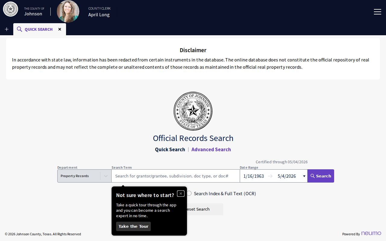
The search surface helps locate an instrument, while a clerk image, terminal, or certified-copy route remains necessary when the record needs official verification.
The county's free Property Alert can send email alerts when a selected name or keyword appears in a future real-property filing, such as a tax lien or release. It is useful for monitoring new filings, not for reconstructing an old deed chain.
Johnson County Street Address Geography
Address labels in Johnson County come from separate systems. County GIS maintains the 911 address database and street-centerline ranges. For an unincorporated structure, placement is assigned from the driveway along the right-of-way. City-limit placement follows road and city rules. A developer submits street names before platting, and an approved plat can be pre-addressed. A corner lot can carry two possible addresses until the building orientation is known.
These layers also explain why a ZIP, a city name, and a parcel label may not agree. Parcel geometry comes from JCAD and GIS, deeds follow legal land descriptions, and ZIP codes follow mail delivery routes. The county's 911 address form is available online or through Public Works for unincorporated addressing. A future-structure request uses an aerial image to mark the driveway, with county contact generally expected within one to two business days and plat addressing commonly taking one to five business days.
Note: A street number, ZIP label, parcel polygon, and city-limit result can all be valid while describing different geographic purposes.
Historic Johnson County Street Directory Clues
Historic printed evidence adds a different layer to a Johnson County street directory search. The 1899-1900 Cleburne transcription on the Portal to Texas History records initials, work, residence or boarding notation, street address, intersections, and sometimes an employer. “Res” means residence and “bds” means boards. Several people at one address may describe a family, a lodging arrangement, or a work-related household. It does not prove a relationship, current location, or ownership.
Search the street name and nearby intersections as well as the surname. The Texas State Library verifies Cleburne directory shelf years of 1921, 1938, and 1947, and the UT Briscoe index documents Cleburne-area telephone listings from 1908 through 2005. No official source verified a complete reverse or criss-cross run, so treat that format as a library question rather than a promised database. The collections and how to read their entries are addressed in the Johnson County city directories.
The Cleburne Public Library local-history archive is the fallback when a printed listing or newspaper image is needed. Its grant-backed newspaper digitization covers 1918-1990 material, while more than 20 years of microfilm remained to be digitized according to the archive page. Search the image after an OCR hit, then pair it with the parcel and deed evidence.
Record a Johnson County Street Evidence Trail
A whole-street search is easier to review when every parcel has its own evidence row. Put the current street form, parcel or geographic ID, legal description, source, access date, and instrument number together. Then write the limited point each record supports. JCAD can support an appraisal and owner lead. A map can support parcel placement. A deed can support a recorded transfer. A directory can support an historical address clue. The row should also say what has not been established, especially occupancy or a relationship between similarly named people.
| Parcel key | Street form, property ID or geographic ID, and legal description. |
|---|---|
| Record source | JCAD, Tax Office, GIS, County Clerk index, directory image, or newspaper image. |
| Date and reference | Access date plus instrument, book/page, account, or image reference when available. |
| Careful finding | State whether the record concerns ownership, geographic placement, correspondence, or historic occupancy. |
Do not turn matching names into a household claim without a source that actually connects them. This simple Johnson County street directory record also makes it easier to revisit a result when the County Clerk, tax search, or a historical image later supplies a correction.
Limits of a Johnson County Street Directory
A street directory cannot establish every person who lives behind a door. Public parcel records identify assessed ownership, not every household member. A mailing address may be off-site. A historic “res” entry can show a past residence but may instead reflect boarding. Voter records have confidential-address exceptions, and the individual lookup is not a public street browser. Utility customer lists, code-case searches, and alarm or animal-register names were not located as public searchable resident sources.
Use the record closest to the question and retain the source date, address form, legal description, and instrument number. A lack of a public result is not proof that nobody lived there. It can reflect an unindexed record, a different street form, a restricted record, or a gap in online imaging. The County Clerk counter, written research request, public terminal, library, Historical Commission, and State Library microfilm routes remain appropriate fallbacks.