
Johnson County Neighbors Through Block Records
Johnson County neighbors are best researched from the map outward, not from a bulk name search. Start with the anchor parcel, identify the parcels that share a boundary, and then open the public record for each selected lot. The result is a carefully limited block picture: parcels, assessed owners, shared land, address labels, and some community contacts. It does not establish everyone who lives on a street.
Each source answers a different question. The appraisal and GIS layers are useful for parcels. The County Clerk records explain transfers and plats. Association certificates can identify a group contact. Election records have specific legal rules and are not a block-directory shortcut. Historical newspapers may add context but need image verification.
| Source | What it shows about a block | Access |
|---|---|---|
| JCAD GIS | Adjacent parcels, boundaries, road geometry, map layers, and parcel IDs | Free dynamic viewer; visible tool details remain a research gap |
| JCAD eSearch | Assessed owner, situs, mailing address, and legal description for a selected parcel | Free research search; owner is not occupant proof |
| County Clerk plats | Lots, blocks, subdivision names, easements, and streets | Public index and copies; fee schedule applies |
| Official Public Records index | Transfer history, shared-owner clues, and recorded subdivision documents | Public index; images and copies vary |
| Cleburne permits | Construction and inspection events tied to an address | CityWorks is dynamic; historic depth was not established |
| Voter lookup or statutory list | Individual status or permitted list fields, subject to protected records | Individual portal or request-and-affidavit route |
| Texas HOA registry | Association name, type, city, ZIP, and management-certificate PDF | Free current filing registry with completeness caveat |
| Local newspapers and yearbooks | Historical notices, addresses, and community context | Digitized or local-history access; inspect original images |
Note: The most reliable result records the parcel and source date first, then treats any personal connection as something to verify separately.
Map a Johnson County Block Parcel by Parcel
The JCAD GIS viewer visibly offers Search for Parcel, Map Layers, and Legend. Search the anchor address, identify its parcel polygon, and zoom until the adjoining lot lines and street names can be read. The research inspection did not verify a radius, buffer, or measurement control, so do not assume one exists. The safer method is to inspect only polygons that actually touch the anchor parcel.
For each adjoining polygon, note the parcel or geographic ID, street address, and subdivision before moving to the public record. A vacant lot, common area, right-of-way, and separately assessed parcel can all sit on the same block. Use the JCAD eSearch record to compare the legal description, assessed owner, situs address, and mailing address. Then check a plat if the layout includes shared drives or easements.
JCAD eSearch supplies the owner, street, parcel-ID, subdivision, neighborhood, and advanced-search fields used after a neighboring parcel has been selected.
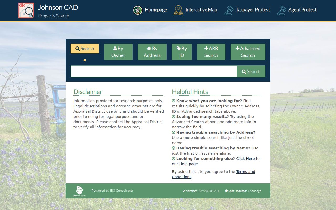
Compare the resulting parcel's situs, mailing address, and legal description rather than treating an assessed-owner name as a confirmed household list.
- Enter the anchor address in JCAD GIS and identify the parcel polygon.
- Zoom to read the adjoining lot lines, road name, and each neighboring parcel identifier.
- Open the selected parcels in JCAD eSearch and record the situs, mailing address, legal description, and assessed owner separately.
- Check the County Clerk plat for lot, block, subdivision, easement, and shared-drive context.
- Use the Official Public Records index only when ownership history or a recorded declaration is needed.
- For a whole named street rather than the immediate block, use the Johnson County street directory workflow.
This process keeps the focus on verifiable geography. A parcel border on a map proves adjacency, not a personal relationship between the people connected to nearby records.
Johnson County Neighbors Need Three Address Fields
A common error is merging an owner’s mailing address with the parcel’s situs address. The situs is the property location being assessed. A mailing address is where an owner receives correspondence. The legal description identifies the recorded land, often by subdivision, lot, block, tract, survey, or abstract rather than by a familiar street number. Those fields can agree, but they often do not when a property is held by an estate, trust, business, tax agent, or an owner who lives elsewhere.
That distinction is the practical Johnson County version of a broader myth: an address label, a voter registration, or a historical res entry does not by itself prove someone currently occupies a parcel. The JCAD disclaimer asks users to independently verify legal descriptions and acreage. A parcel card is valuable evidence, but it should be paired with the correct source for the question being asked.
- Situs address
- The actual location of the parcel on the appraisal roll.
- Mailing address
- The correspondence address for the owner or tax contact; it is not automatically a residence.
- Legal description
- The land description in a recorded instrument, such as a lot and block or survey and abstract.
- Parcel ID
- An appraisal or GIS identifier used to connect a mapped parcel with its assessment record.
Johnson County Neighbor Plat Records
A plat is the recorded drawing that connects streets with subdivision lots, blocks, easements, and other physical relationships. When mapped parcels touch at a narrow strip or share a drive, a plat can explain why. Start with the subdivision, lot, and block on the JCAD record, then search the Johnson County Official Public Records index for the matching instrument. The County Clerk’s fee schedule lists plats at $80 and additional pages at $25, so check copy options before ordering.
Recorded deeds, releases, liens, and easements may also explain a name change or a shared interest, but they are ownership and land records, not a current roster of neighbors. The clerk’s online data is not the official repository. Public-access terminals and the clerk’s copy-request route remain the fallback when a needed image or older book is not available online.
Note: A plat settles land geometry more reliably than a postal label, but it does not establish who resides in every structure on the block.
Johnson County Neighbors and Voter Limits
The state voter tool is built to confirm one person’s registration status. Johnson County directs users to the Texas Voter Information route, which uses a VUID, Texas driver license or DPS PIN route, or a name plus county and date of birth. It is not a browseable street directory. Never enter another person’s sensitive identifiers into a public search form, and do not infer a household from a precinct result.
Texas Election Code Chapter 18 permits statewide voter-list requests under defined conditions. Requestors can seek active, suspense, or cancelled records and county filters, but protected addresses and identifiers are withheld. The statutory process also requires an affidavit barring use with advertising or commercial promotion. A voted ballot never identifies a person’s choices, and public election records should not become a named block list.
The Johnson County Elections public-information page identifies election-record categories and confidential fields. For status questions, use the official individual lookup. For a permitted list request, use the state form and follow the restrictions stated by the custodian.
Johnson County Neighbor Association Records
The Texas HOA Management Certificate Search is the strongest official association inventory found for Johnson County. Its filters include name, county, city, ZIP code, and association type, including POA and COA. Search results can link to a management certificate with a mailing address, designated representative or manager, website, recording data, and transfer or resale fees.
The registry is a current filing source, not a membership directory. It warns that user contributions may not be complete, reliable, or valid. Governing documents and membership rosters are generally not public through that search page. Recorded County Clerk declarations and the association’s own contact route are the right next steps when a subdivision name appears on a parcel record.
Chisholm Hills Residential Community
Listed in the Johnson/Cleburne/76033 registry segment. Confirm the certificate before relying on a contact detail.
Community of Nolan River Estates
Registry result with association-contact potential, not a list of owners or residents.
Cross Creek Estates of Cleburne
Owners association named in the official certificate-search results for the local segment.
The Retreat Property Owners’ Association
Association name surfaced by the registry; the certificate is the record to inspect for filed details.
Other results in that segment include Remington Ridge Phase III-V HOA, Belclaire Residential Community, Craftsman’s Corner HOA, Legado Residential Community, Custard Farms Homeowners Association, and Owners Association of Belle Meadows. Cleburne’s Resident Guide links homeowner-association information to a third-party directory, so use it only as a lead, not a complete official roster.
The Cleburne Chamber business directory is a separate civic overlay. Its keyword, category, and alphabetical search can return public business names, categories, addresses, and phone numbers. It may help identify a local organization’s service area, but it does not document residential neighbors. The Cleburne Resident Guide can provide city service-area context, while the state certificate registry remains the official association-filing route.
Johnson County Neighbors in Historic Papers
For a past block, the UNT Johnson County newspaper collection and the Cleburne local-history archive provide a different layer of evidence. The collection supports name, title, metadata, and full-text searching. Historic papers can place an address in a legal notice, obituary, civic event, or address-change item, but OCR must be checked against the scanned page.
The 1899-1900 Cleburne directory transcription uses residence and boarding abbreviations, occupations, intersections, and employer references. Several names at one address might reflect a household or lodging arrangement, not a proven relationship. Use that historical clue with a census, a plat, or a deed rather than applying it to a present-day block.
Official Records Versus Neighbor Tools
Commercial neighbor-search categories often blend address histories, marketing data, and public-record indexes. Their data can be stale, can mix people with the same name, and may not identify the underlying source. A Johnson County parcel, clerk, election, or association record is narrower, but it makes clear what it can and cannot establish. Use the official record when an address, ownership question, or association contact matters.
| Official local record | Useful answer | Limit |
|---|---|---|
| JCAD parcel record | Assessed owner and parcel details | Does not prove current occupancy |
| County Clerk index or plat | Recorded land transfer and subdivision geometry | Does not create a household roster |
| HOA management certificate | Association filing and possible contact route | Not a member directory |
| Official voter channel | Individual status or lawfully requested list data | Protected information remains withheld |
Keep the source name, search date, parcel ID, and document number with any finding. That evidence log makes it clear whether a conclusion rests on a map boundary, a record owner, or a historical reference.
Johnson County Neighbors Have Privacy Limits
Public block research has firm edges. Renters, non-owner household members, utility customers, delivery records, and unlisted occupants are outside this method. Texas protections can suppress addresses and other data for qualifying voters and Address Confidentiality Program participants. Court, motor-vehicle, adoption, juvenile, sealed, expunged, and protected-victim information may be restricted or unavailable.
The Texas Address Confidentiality Program gives qualifying survivors a substitute mailing address and limits disclosure of the true address. It does not erase every public record, but it is a reason never to try to reconstruct, publish, or circumvent a protected location. Texas public-record access does not override a statutory confidentiality rule.
Lawful use. Johnson County neighbor research is for personal, lawful purposes such as understanding property geography or reconnecting with a community. Do not use it to stalk, harass, intimidate, or harm anyone.
Note: No official umbrella neighborhood-association directory, block-watch roster, congregation roster, or named Cleburne neighborhood map was located in the research.